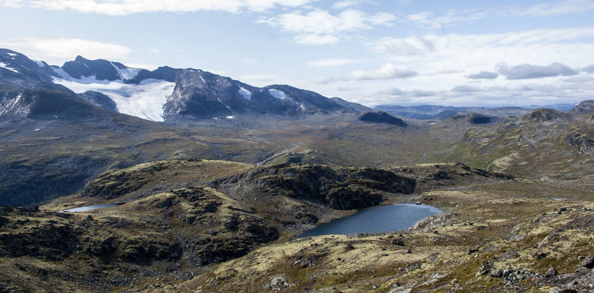
Gjendetunga from Gjendebu
A little scenic peak in Jotunheimen, offering stunning views over ake Gjende.
A little scenic peak in Jotunheimen, offering stunning views over ake Gjende.
Gjendetunga is the perfect hike for those who want to indulge in a nice, relaxing and shorter trek, but who doesn’t want to go without a panoramic view experience. Towering over Gjendebu, Gjendetunga lies at 1516 MASL (4973, 7 feet) and is “a not to miss” hike if you’re in this area. On clear days you can enjoy your lunch at the top of the mountain overlooking Gjende and its surrounding mountains in the East and the mountains ranges in the West. This is a road less travelled, but the Gjendetunga hike has earned its rightful place as one of the best ways to experience Gjende.
Interactive map of Gjendetunga
Difficulty: Moderate
Time: 3-5 hour(s)
Distance: 10 kilometers
Ascent height: 520 meters
Descent height: 520 meters
Gjendetunga is the perfect hike for those who want to indulge in a nice, relaxing and shorter trek, but who doesn’t want to go without a panoramic view experience. Towering over Gjendebu, Gjendetunga lies at 1516 m.a.s.l. (4973, 7 feet) and is “a not to miss” hike if you're in this area. On clear days you can enjoy your lunch at the top of the mountain overlooking Gjende and its surrounding mountains in the East and the mountains ranges in the west. This is a road less travelled, but the Gjendetunga Hike has earned its rightful place as one of the best ways to experience Gjende.
The start of this trail doesn’t have a very clear path. Walk west through the birch wood with the river on your right hand side. Soon you'll reach the foot of the mountain and start the ascent. At the top you will see the Gjende lake in front of you, and Storlådalen and Skardalstinden in the north-west.
Coming down from Gjendetunga, you can either walk down the backside or take the same path you took coming up. Walking down the backside, you'll walk through varied green terrain where you can find blueberries.
Storlådalen lies north-west of Gjendetunga, and is a perfect U-Valley; in the course of thousands of years, the massive glacier cut out a wide, deep and slanted valley. Today the glacier is completely gone, leaving only behind this mesmerising valley and heaps of gravel, rock and dirt, located further up the valley. A build-up of loose materials has made way for the creation of many streams, creeks, ravines etc. in the valley.
The sides of the Gjendetunga mountain are quite sheltered and faces the fun, making it a thriving place for flora. As you walk from the shores of Bygdin and towards the peak you'll through many types of vegetation; lush birch forest, heath and moss area, and fell. On the path youll find a range of flowers such as Blue heath (blålyng), Purple mountain saxifrage (rødsildre) and glacier buttercup (issoleie).
Today the peak Gjendetunga is surrounded by fell and some bog land, and further down birch wood. Recently, remains of pine wood dating back 5,700 years have been discovered in the pockets of the wetlands. Buried deep and protected by the pockets in the wetlands, the wood was fresh and still had a smell of pine. The findings have led people to believe that there was once a pine forest in this area, and that parts of the bare fell was once covered by a pine forest.
This hike is medium and suitable for those in average physical shape, and children from the age of 6.
The main season is summer/late summer. This is when the area is most suitable for trekking.
Stay at Gjendebu Mountain Lodge is located on the bank of Gjende Lake.
You can access the area from Gjendebu
